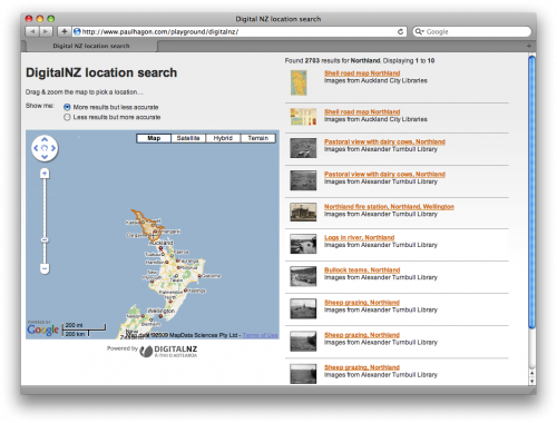
Over the past couple of months I’ve been building a little application using the API’s from the DigitalNZ project. DigitalNZ is a collaboration between government departments, publicly funded organisations, the private sector, and community groups to expose and share their combined digital content. Part of their plan to expose their data is to provide a publically available API for developers to expose their content in ways they may not have thought about.
Typically, a large dataset has a search box as it’s main interface. I wanted to get right away from that approach and create an engaging interface. This uses a map interface to allow the user to freely explore the content.
It currently uses a combination of API’s from Google and Flickr to convert a latitude and longitude from the map to obtain a place name. It then displays a shapefile from Flickr to approximate the area being searched, and returns a list of relevant results from DigitalNZ. Since I started work on this, the data returned from both of these API’s have been released under a Creative Commons license (Yahoo have released their geoplanet data and Flickr have release their shapefile data). I’ll end up incorporating these releases into the application rather than relying on the API’s for the functionality.
Explore the contents of DigitalNZ.
